
This page is part of © FOTW Flags Of The World website
Sinaloa (Mexico)
Free and Sovereign State of Sinaloa [Estado Libre y Soberano de Sinaloa]
Last modified: 2025-04-19 by daniel rentería
Keywords: mexico | sinaloa |
Links: FOTW homepage |
search |
disclaimer and copyright |
write us |
mirrors
|
![[Defacto flag]](../misc/fis_defa.gif)
![[Design is an acceptable variant]](../misc/fis_vari.gif)
![[State flag]](../misc/xoxxxx.gif)
|
|
.gif)
|
Images by Pascal Gross and
Juan Manuel Gabino Villascán, April 20, 2002
|
|
|
|
Municipalities:
See also:
Other sites:
Presentation of Sinaloa
- Official name: Free and Sovereign
State of Sinaloa [Estado Libre y Soberano de Sinaloa]
- Short-form names: State of Sinaloa [Estado de Sinaloa], Sinaloa
- Location: North-West of Mexico.
It limits the Mexican States of
Sonora (NW),
Chihuahua (N),
Durango (E) and
Nayarit (SE); the Gulf of California (W) and the Pacific Ocean (S).
- Area: 58,092 km2 (2.9% out of Mexico)
- Municipalities: 18
- Population: 2,536,844 inhabitants
- Capital: Culiacán (Pop.: 745,537)
- Statehood: 14 October 1830
- Flag adopted: unknown date
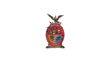
- Arms adopted: November 29, 1958
- Arms designer: Rolando Arjona Amábilis.
INEGI and SEP
Anything below
this line was not added by the editor of this page.